

Well, this was long awaited wasn't it? The last project from third year design, Information Design 3. Excuse my laziness, but I had completely forgotten I had photos of the final project.
Our goal was to create a wayfaring system, with a theme, for downtown Toronto. Wayfaring is pretty easy to describe: something that helps you find your way. Like maps, signs, etc. Some of my classmates chose to make design related systems (that showed where to find the best typography downtown, bookstores with great design references, and design firms), another made a system for shop owners on Yonge street that would help tell customers when each store was open or closed.
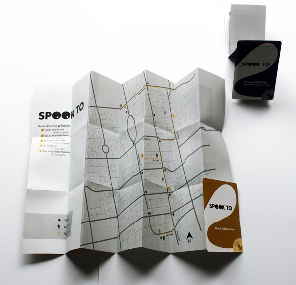
Mine was a tourist-centered project, that focused on giving people a selection of haunted tours of Toronto to use. The project uses both print (hand-held maps colour coded for each tour), and electronic (phone numbers at each site, printed on signs, that users may call to receive detailed information about the ghosts on site) elements.
These are pictures of the mock-up maps. Each colour designates a different tour, and to help with navigation each includes a photo of the buildings on the tour. For the purpose of the project we only had to mock-up a few maps, or samples (not everyone used print for their projects). But we had to have several other options laid out, as if we were pitching the idea to a client.
No comments:
Post a Comment